The Island
I’ve just returned from a private trip to Lille in France, where a few things inspired my appetite for all things geo-urban.
For starters, the name of the city is the story of its past. Lille is a contraction of “le île”, which is French for “island”. Lille used to be a merchant canal city, and the waterways no doubt served the dual purpose of defence and transit. Whilst taking a stroll I happend upon an old copperplate reproduction of a city map in an antique store, which I photographed and have combined with a Google Earth screenshot to locate the extent of the old town:
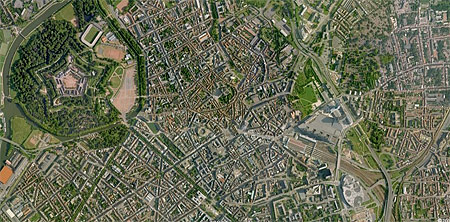
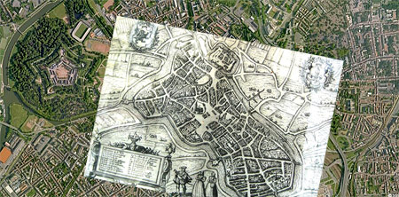
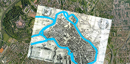
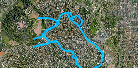
It’s surprising how easy this kind of amatuer geo-urban detective work can be, and matched only by the private delusion of having been the first to uncover something previously unknown.
Also impressive were the following two buildings on the Place du Théâtre:
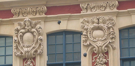
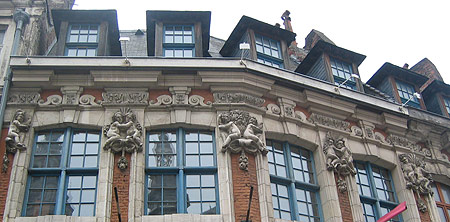
The first photo shows cannonballs lodged in a façade, which, if I’m piecing together an anecdote and recorded history correctly, must have come under fire from the Austrians in 1792 just after the French revolution. When I first visited Berlin I was pretty shocked by the WWII bullet holes which still pepper the front of buildings across the city. But this is something else altogether. My uncle dryly commented that the cannonballs are painted gobs of plaster, attached much later to attract the interest of gullible tourists, but I’m a sucker for this kind of thing and am sticking to the first story.
The second picture shows a façade which was also pointed out to me by family friend and Lille resident, Patrice, who took me on a 30 minute whistle-stop historical tour of the town. She focused my attention on the cherubs whose postures are encoded statements about the interior layout: hugging cherubs denote adjoining rooms in the same apartment; cherubs sitting back-to-back denote the load-bearing wall separating apartments.
Here’s an embedded Google Map of Lille, which I’ve included simply because of late, you can.